Utility and occupancy geographic analysis
Norristown State Hospital Land Planner Feasibility Study
Michael Baker International Planning Consulting | 2018
These maps were created via heads-up digitization—adding points by hand—of dozens of old civil engineering large scale plots. Property lines, building outlines, utility lines, tunnel spaces, and manholes were drawn individually in ArcMap and combined with spreadsheet data showing utility sizes, utility and building uses, and building tenants. I created 20 maps, using formatting solely from ArcMap because maps were often iterated upon and re-exported. A selection of these maps were used in the Norristown State Hospital Land Planner Feasibility Study.

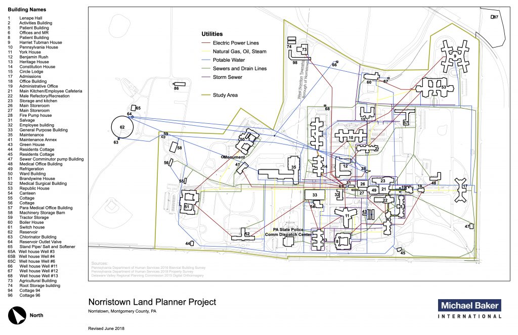
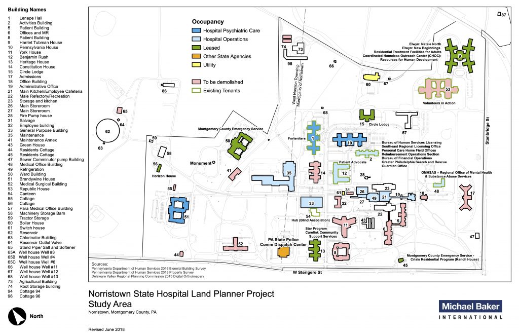
Created by James Graef; used with permission from Michael Baker Intl.
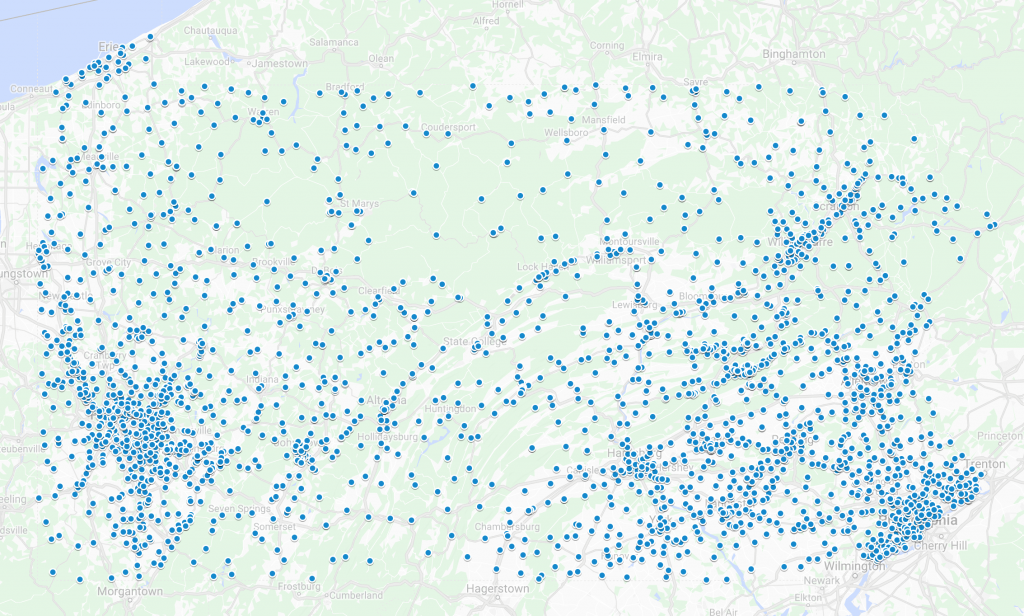
KML Google Earth multigeometry problem solving
Michael Baker International Planning Consulting | 2017
To assign zip codes to a set of hundreds of addresses, I used Google MyMaps for its auto-locating capabilities. However, MyMaps turns auto-located points into ‘multigeometries’ upon export, so I needed to separate the point data from the extraneous data around each for import into GIS Software. To do this, I used Automator to code a service which would delete the extraneous lines of code from an exported KML file. This problem hadn’t been solved online, so I posted the process on the Google Maps Product Forum. For more detail about the process, the post can be viewed here.
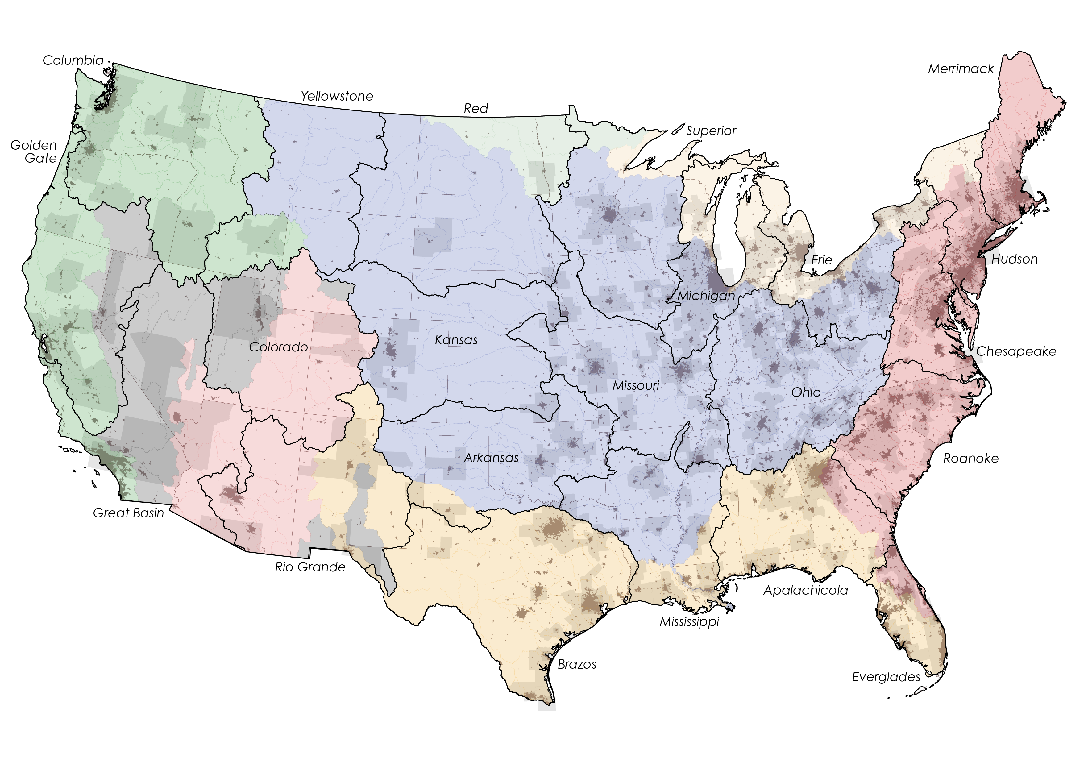
US Map Projection and Format Manipulation
arch 491 individual studio project | 2020
part of a three-part series on cities and water: see all three
I used ArcGIS Pro to project shapefile data of the US—state, watershed, combined statistical area, urbanized area boundaries—using a Lambert Conformal Conic projection, so the final output would not have the compressed and drooping appearance of unprojected longitude and latitude. Then I converted the shapefile data to layers in Rhino where they could be edited by Grasshopper parametric modeling software. See the full project >