arch 491 individual studio project | 2020
Darla Lindberg, Professor
part of a three-part series on cities and water: see all three
Borders between jurisdictions would often be more efficient if they followed existing watershed and development boundaries, rather than historical lines on a map. Small watersheds could be grouped into regions and megaregions based on propensity scores. These regions would be better able to coordinate cities and natural resources, because their borders would be on the natural boundaries between urban areas and water bodies. This will become increasingly important as climate change threatens freshwater resources more and more—groundwater and aquifer recharge zones are generally slightly offset from but reasonably similar to watershed boundaries.
One proposed set of watercity regions (black lines) colored by drainage basin. Grey: multiple types of city boundaries.
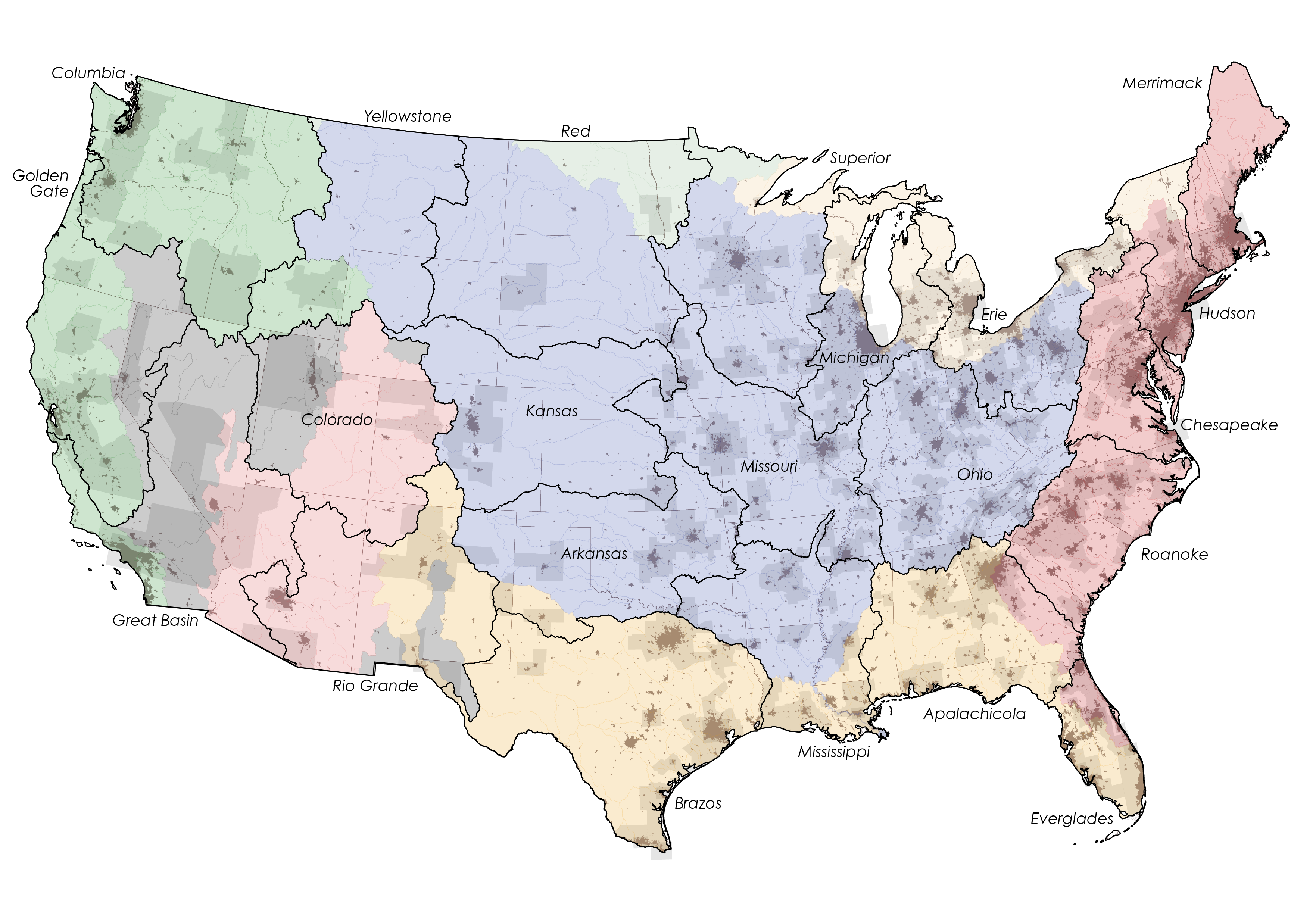
This map collates shapefile data projected using ArcGIS Pro.
View my GIS Software experience >
Watershed boundaries are well-suited to be political boundaries because they fall at relatively high elevations which are often less conducive to development, and because no water crosses them, limiting erosion and the possibility of moving borders. This proposal, and most maps based on watersheds, align well with Native American territorial boarders. In this way they connect with history and with land as much or more than existing state boundaries.
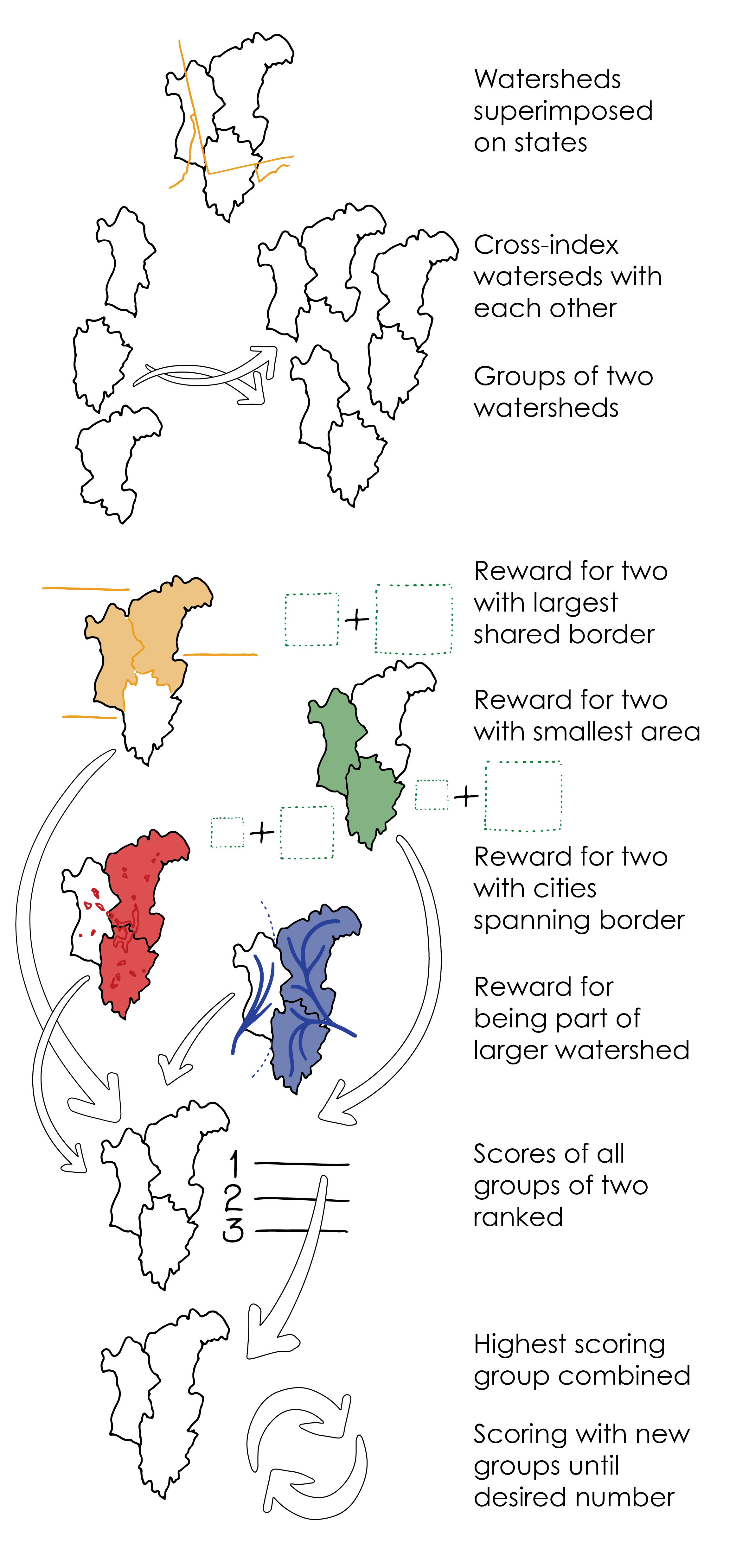
The above proposed set of watercity regions was created with a Grasshopper script acting on GIS data in Rhino. The script analyzed each pair of adjacent watersheds based on four factors and assigned each a propensity score. The weight of each factor could be adjusted to create different proposals—prioritizing similar areas in each final state, for example. The pair of watersheds with the highest propensity was combined, and the process repeated until the desired number of combined watersheds was reached. See the script and learn more about my work with Grasshopper >
Graphical representation of grasshopper script
In future iterations, the script could add population of watersheds as a factor for consideration. It could also start with a few ‘seed’ cities—which might become state capitals—and grow states from those centers, so urban centers are well distributed.
This proposal is part of a three-part series on cities and water. See all three or view them in a project booklet: