arch 491 individual studio project | 2020
Darla Lindberg, Professor
part of a three-part series on cities and water: see all three
Historically, when a city met a small stream, that stream was buried in a culvert and development was placed on top. Now, with suburbs as the dominant development pattern at the rural-urban interface, mandatory open space requirements are often fulfilled with marginal land on the edges of property near streams.

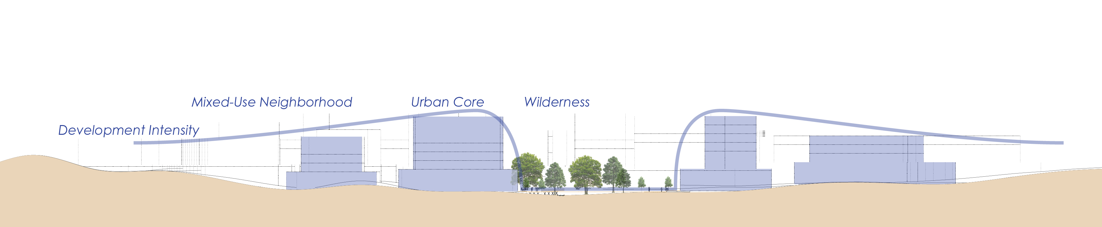
Leaving this land barely used decreases development density and walkability, leading to more sprawl which impacts more small streams. And suburban streams are almost as invisible as those in culverts. Instead of abutting the backs of strip mall developments to steams, we should see water as an amenity which anchors walkable, dense, mixed-use development.

As Slab Cabin Run travels under Atherton St southeast of State College between University Dr and Branch Rd, it is bordered by the backs of strip malls and parking lots. Instead, dense development could face urban riverwalks along a natural buffer directly adjacent to the stream.
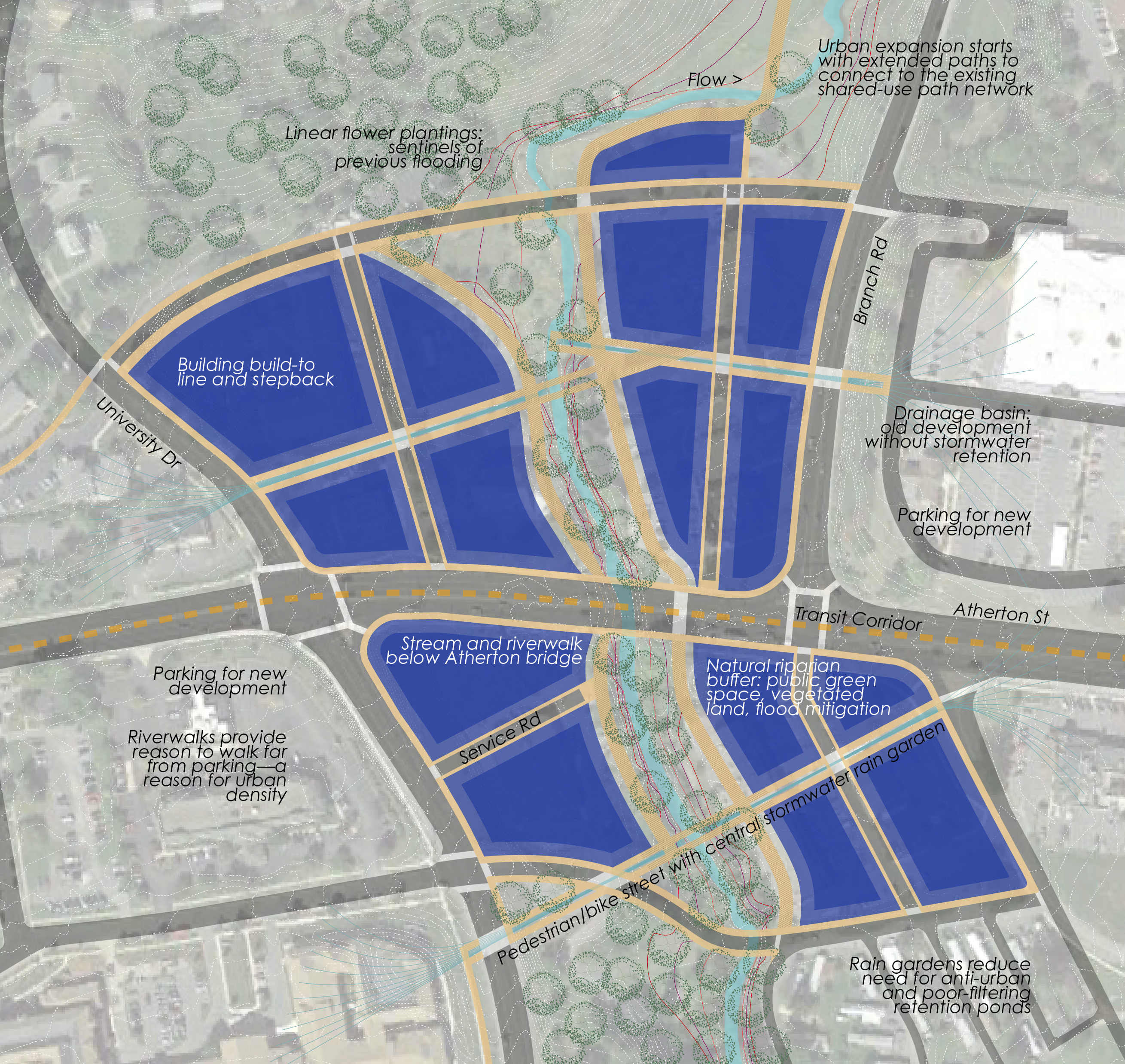
Much of the development around the site was built according to outdated stormwater standards. Select new streets perpendicular to Slab Cabin Run would host rain gardens along their length, rather than space for cars. These roads would funnel stormwater runoff from nearby developments, filter it, and slow it as it travels to the stream. These natural spaces would function as education and play spaces, in addition to their ecological functions. Water-powered ram pumps could maintain hydration of the rain gardens even when there is little rain.
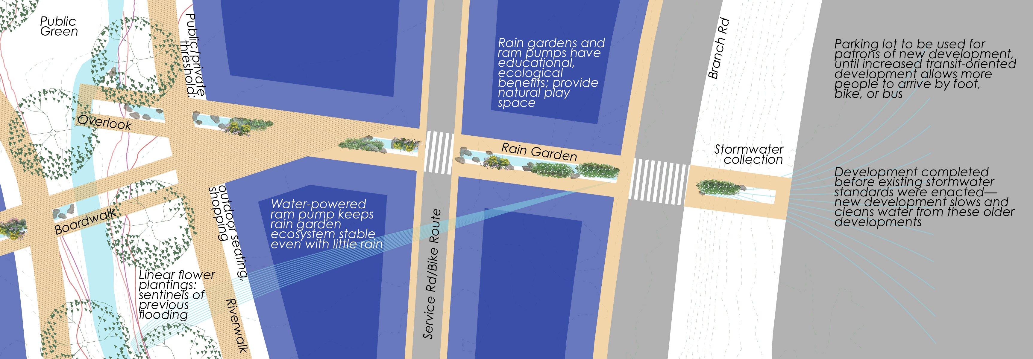
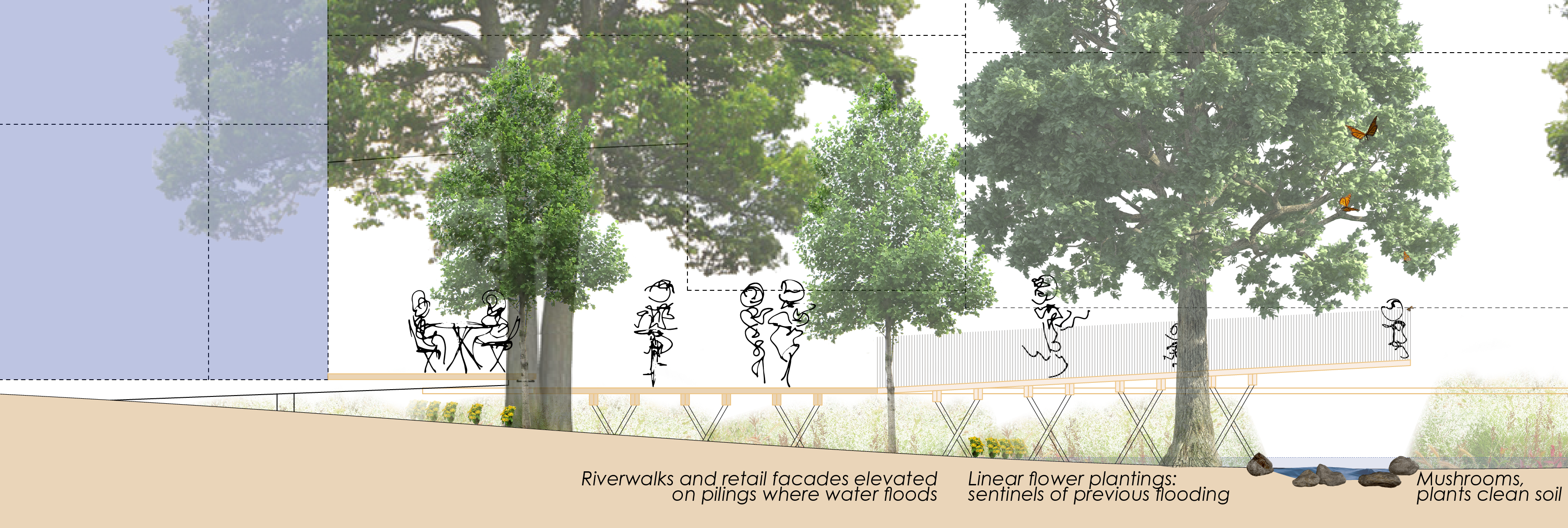
The development’s main retail corridors would be its riverwalks. These riverwalks and adjacent infrastructure would be above ground level to allow nature to expand and contract as necessary, especially for flooding. Between the riverwalk and the building facades is a public/private threshold, which could host outdoor dining, shopping, and events.
Initially, the river would act as a reason to walk farther from parking than is normally required in the suburbs. To the extent possible, parking necessary when the project is first built should be provided by the excessive parking located at adjacent developments. As the urban core slowly expands, virtuous cycles of street life and density encouraging transit use would make parking less necessary, and adjacent sites could be developed into dense, mixed-use extensions of the river development.
This proposal is part of a three-part series on cities and water. See all three or view them in a project booklet:
See another proposal for a riverwalk in the Centre Region: Northland, Ferguson Township.