arch 491 individual studio project | 2020
Darla Lindberg, Professor
part of a three-part series on cities and water: see all three
Zoning is often used to disallow increased housing supply, to the benefit of property owners and to the detriment of renters and those who would have moved in if more housing was available. Zoning decisions are also often relatively arbitrary—based on owners of parcels, or highly-involved citizens. Parametric modeling may be able to produce a more equitable and efficient roadmap for development.
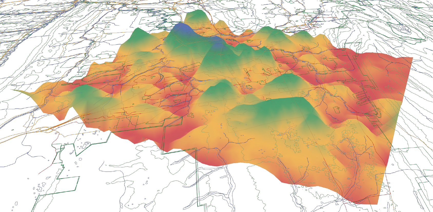
This development heat map of the Centre Region was created with a Grasshopper script acting on GIS data in Rhino. A grid of measurement points is overlaid on GIS layers: cities ranked by population, transportation corridors, water bodies and sensitive areas, and slopes and conserved land. Each GIS layer creates its own heat map based on the location of features relative to nearby measurement points. Then these heat maps are factored together to create a complete roadmap for future development. See the script and learn more about my work with Grasshopper >
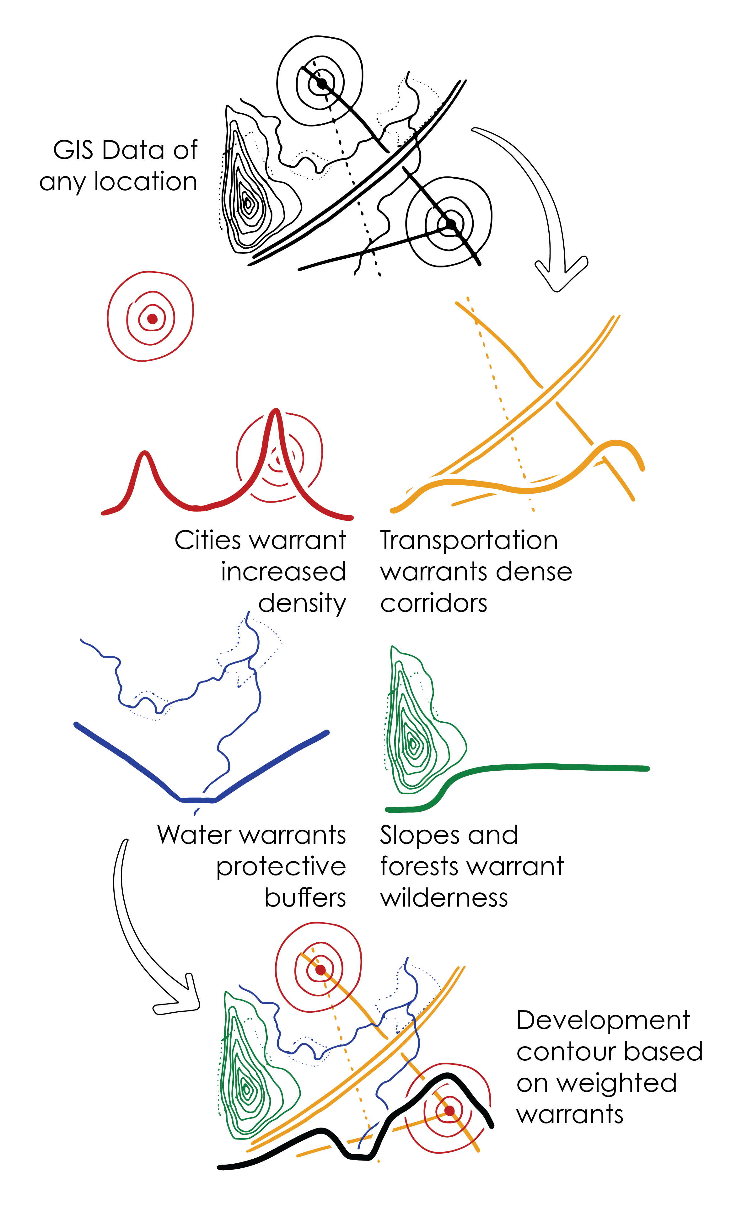
The parametric process allows community input to be systematically, rather than arbitrarily, applied to the final plan. The values of the community—open space near parks, density near transit—can inform the draw and weight of each feature on the overall heat map. Draw determines how concentrated the effect of a feature is, while weight determines how much the effects of one set of features impacts the combined heat map.
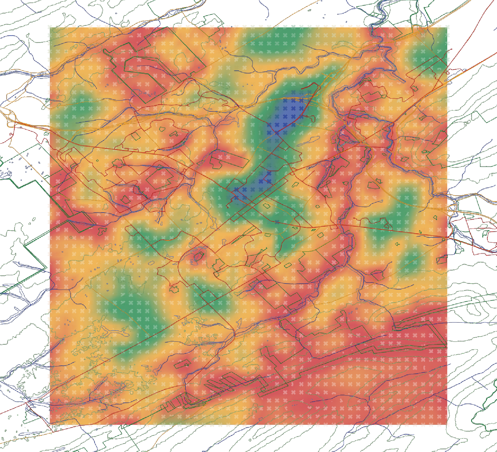
Development heat map for the Centre Region.
Measurement points: Xs
Future heat maps should be analyzed at higher resolution than the example shown, so conditions like riparian buffers can be highly targeted. Additionally, GIS data should be more stratified: high-frequency transit deserves more adjacent development than roads with little traffic; larger streams should have larger buffers and more development capitalizing on the natural landscape, as compared to drainage ditches.
This proposal is part of a three-part series on cities and water. See all three or view them in a project booklet:
See also an extension of this project which generates neighborhoods parametrically.