individual independent project | 2021
created as an extension of my Parametric Transect Zoning tool
This grasshopper script visualizes what a region, city, or neighborhood could look like with new zoning regulations upon full build-out. It was used to visualize what a section of the Centre Region could look like as a mixed-use neighborhood called Northland. The script works using only four datasets:
1Centerlines of existing or future streets and relevant parcel boundaries. This example shows a suburban commercial section of Ferguson Township, PA extending along Atherton Street. Centerlines are separated into roads with bike lanes, those without, pedestrianized streets and riverwalks, and alleys.

2Information describing each type of street: width of sidewalks, number of vehicle lanes, locations of bike and bus lanes, etc.
3The proposed zoning districts. The images below show existing and proposed zoning maps for the Atherton corridor. For the grasshopper script to function, however, polygons need only encircle the center of each block.
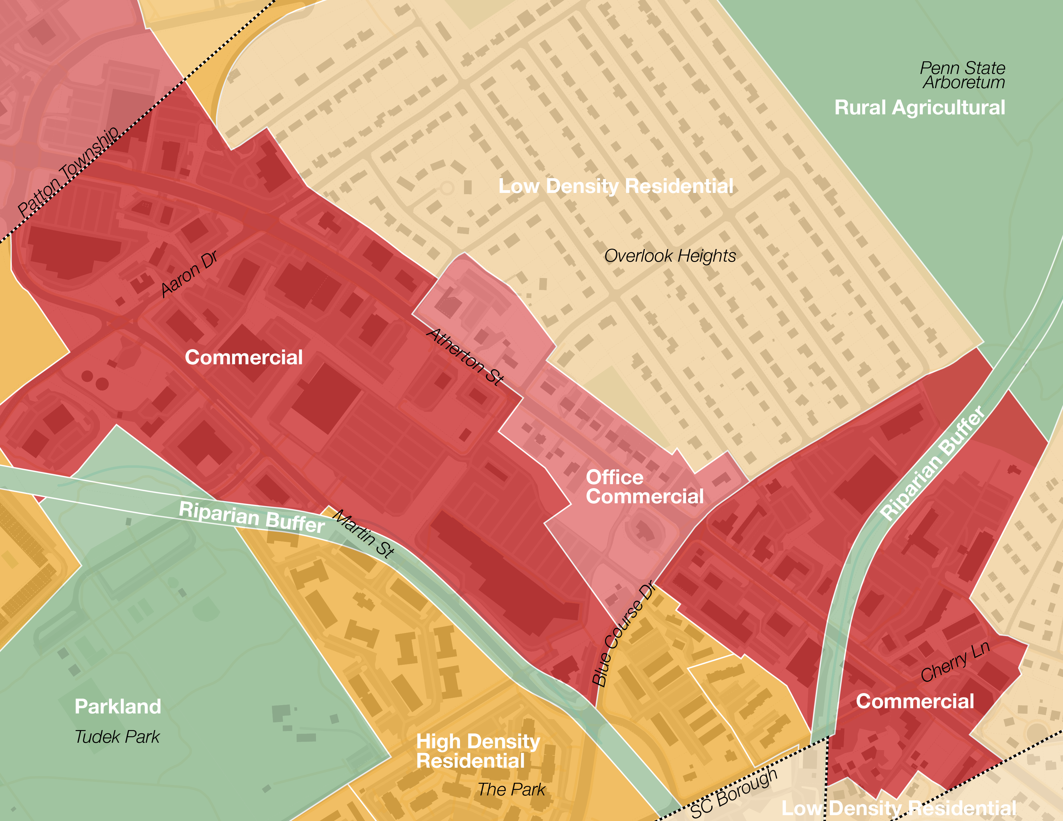
Existing zoning 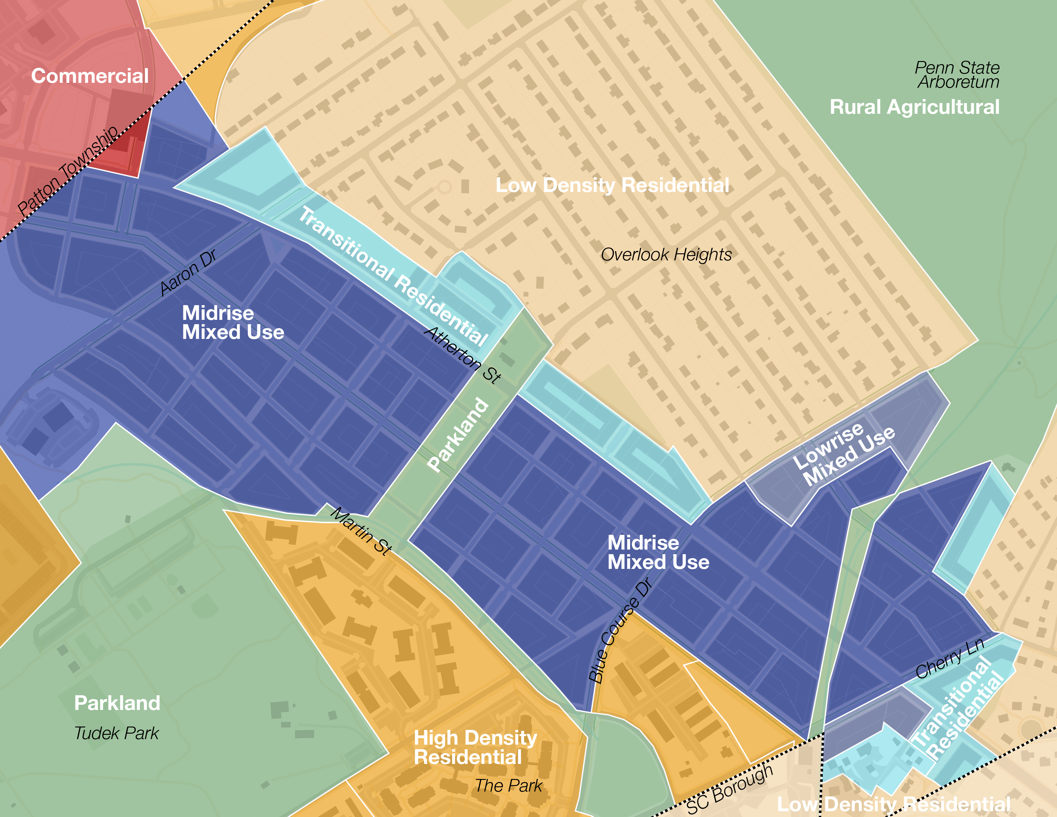
Proposed zoning used by script
4Regulations for each zoning district, including number of floors, floor height, and size of building podiums.
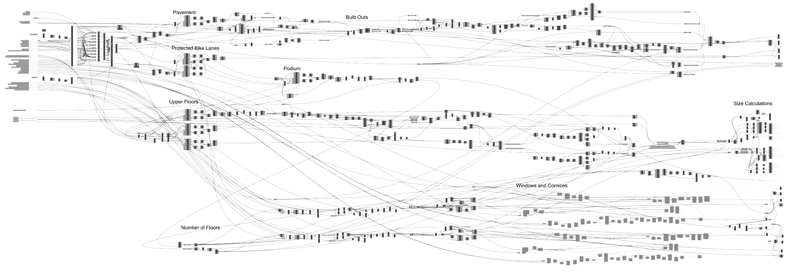
Grasshopper script: pavement edges including bulb outs and protected bike lanes; building masses with windows and cornices; number of units and FAR calculations
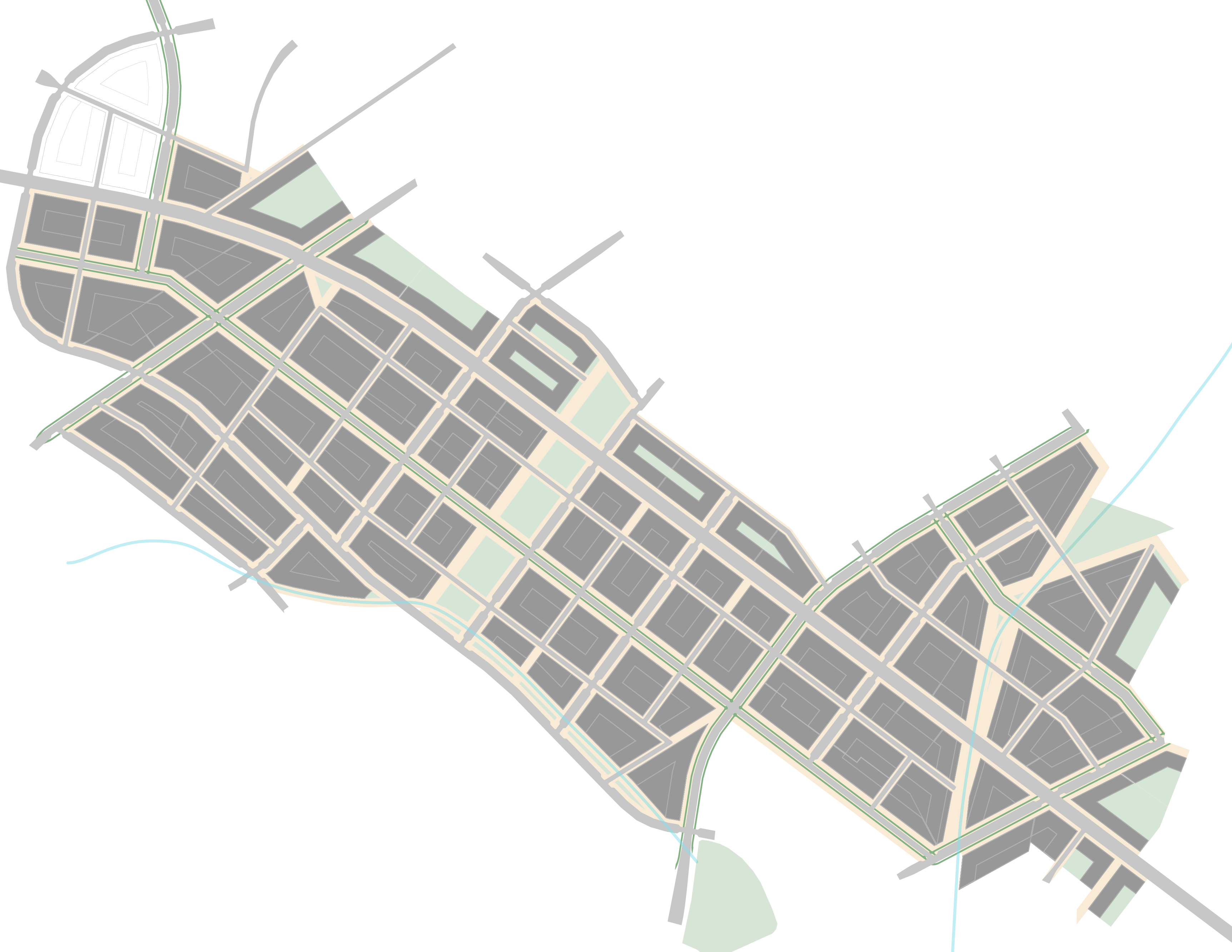
Grasshopper synthesizes these four datasets into a model of potential street layout and development according to the established parameters. The script adds bulb outs to intersections with streets that include curbside parallel parking and creates protected bike lanes and protected intersections where specified. It also determines a reasonable building massing for each block and adds cornices and windows based on adjustable dimension parameters. Adding GIS context can establish massing of nearby existing development. Learn more about my work in Grasshopper.
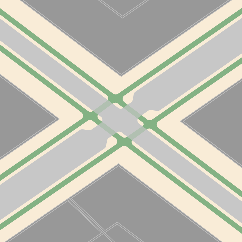
Bulb-outs on specified streets, protected bike lanes and protected intersection, and building massing produced from two intersecting street centerlines
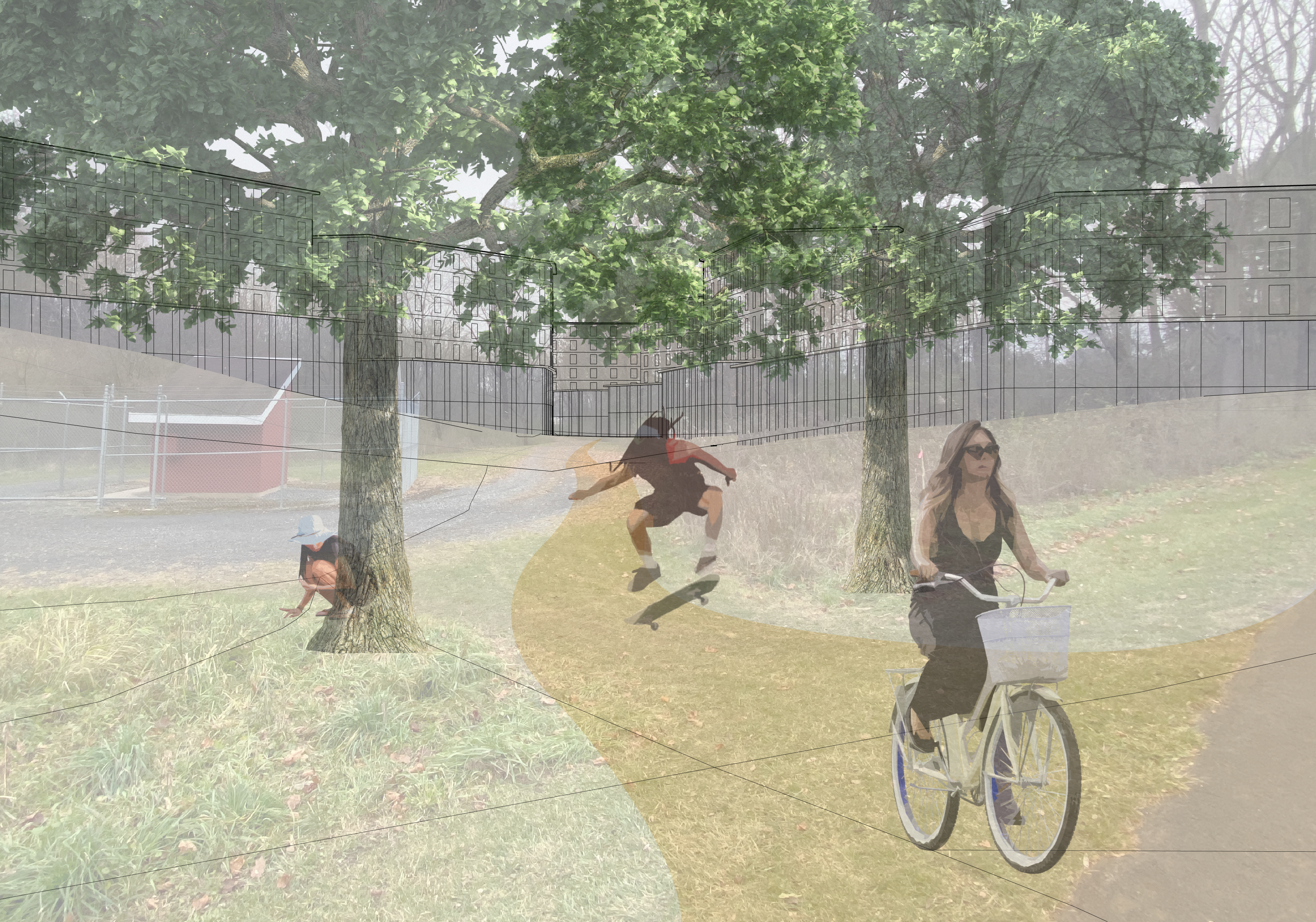
The script also analyzes the space available in each proposed building and calculates the number of residential units and beds expected upon full build-out. The tool could allow municipalities and the public to visualize consequences as they iterate on zoning proposals, in real time.
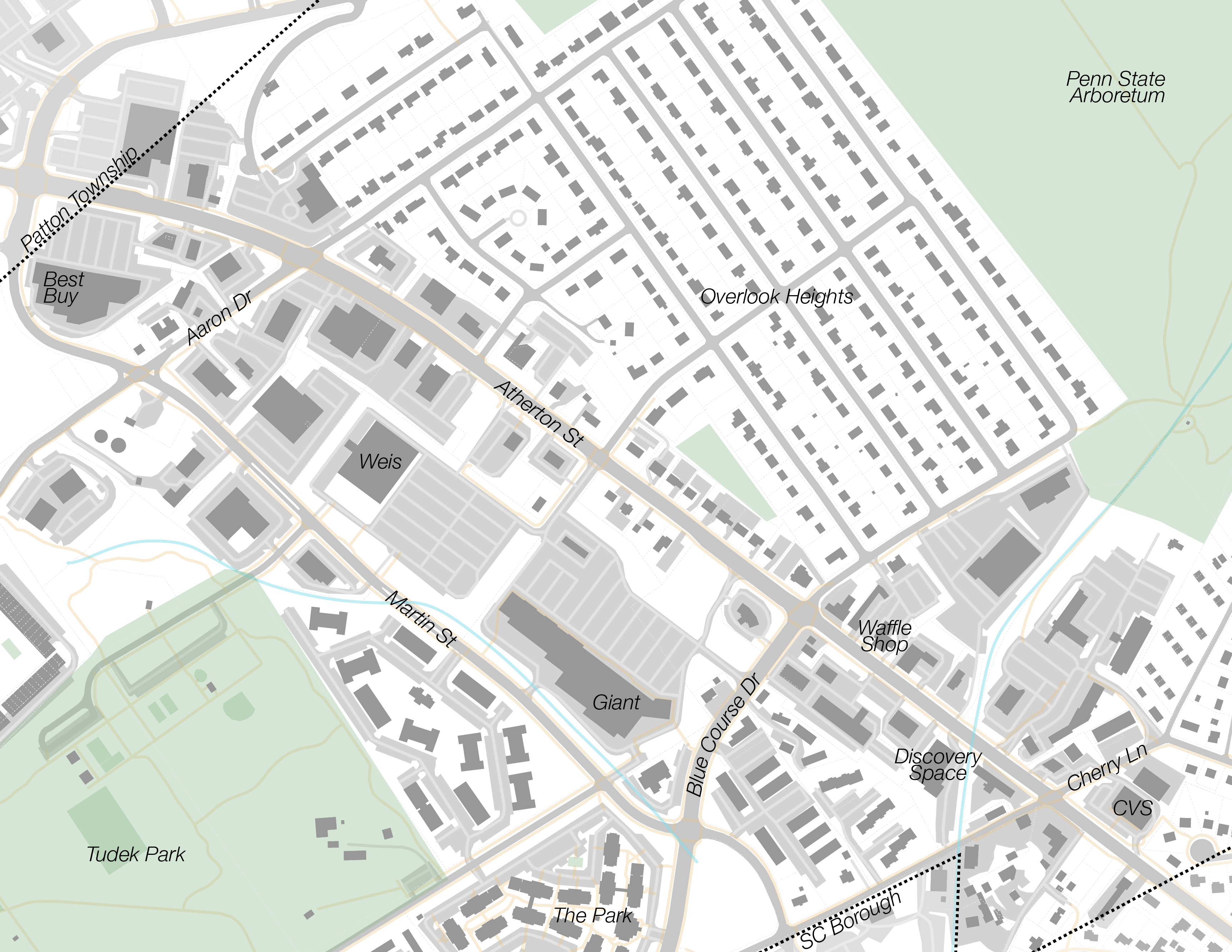
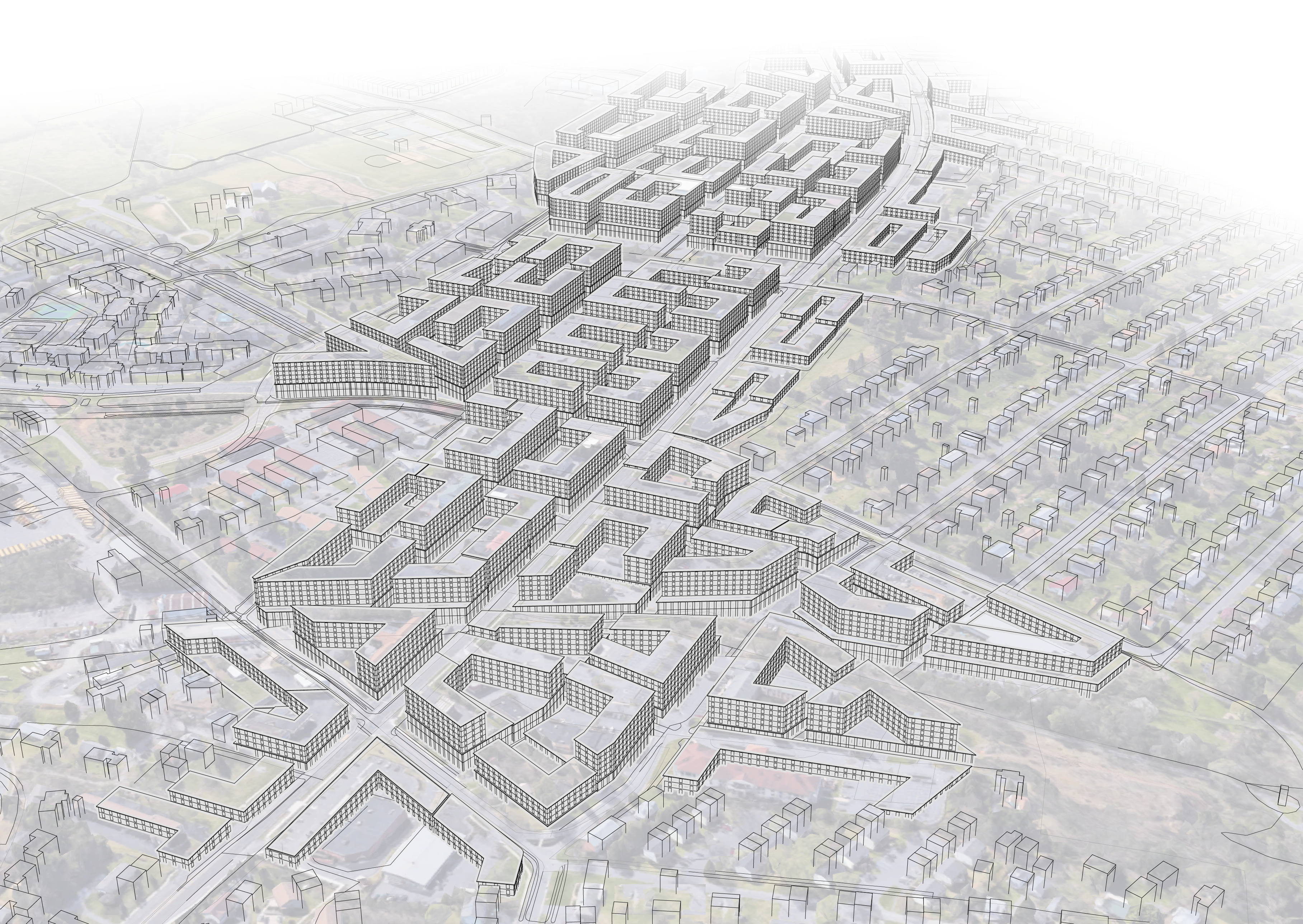
Existing study area 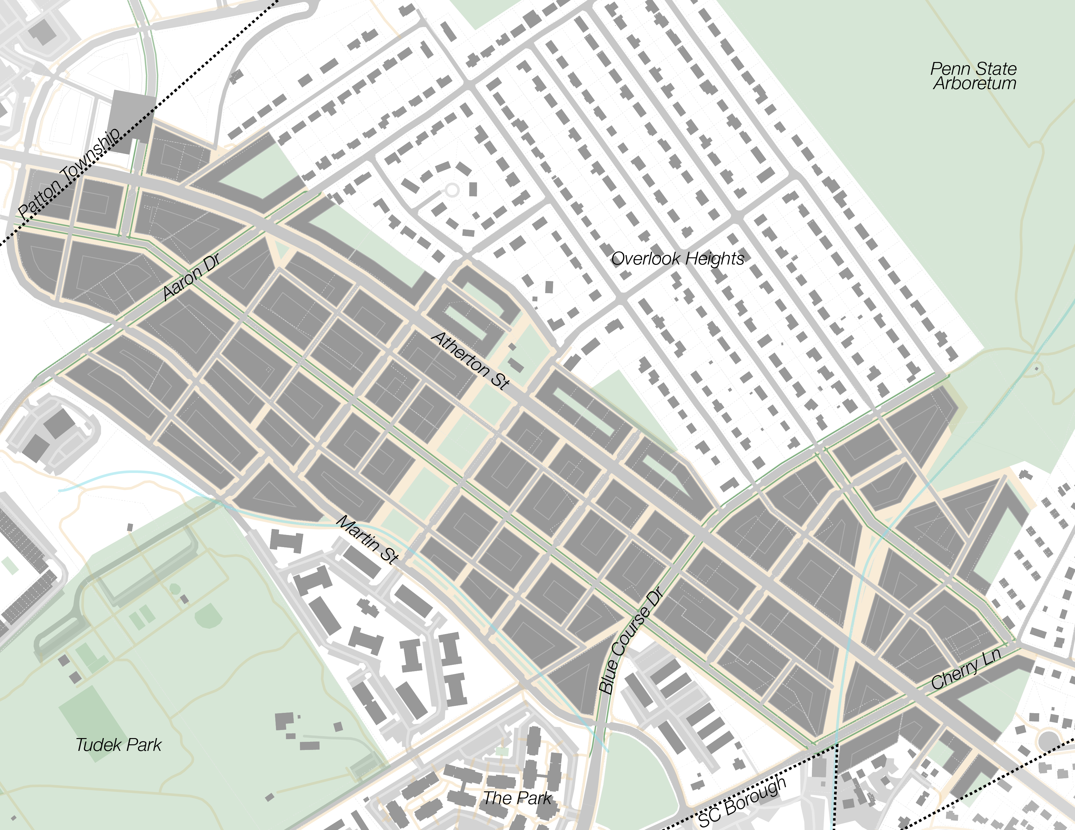
Fully realized Northland 
Existing study area Fully realized Northland
In the future, the script could create more detailed models or recommend pictures from a database of streetscapes based on the proposed building massing and streetspace allocation.
View the results of this project in my Northland proposal.
See also an extension of this project which generates a heat map of potential development for an entire region based on GIS inputs.
Neighborhood Builder is a trademark of James Graef.