The following three projects demonstrate my skills in Grasshopper. I am especially experienced in manipulating GIS data to work with Rhino and Grasshopper.
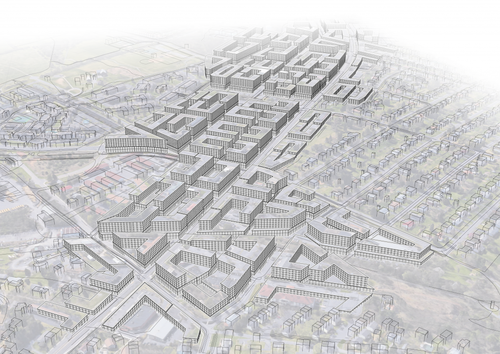
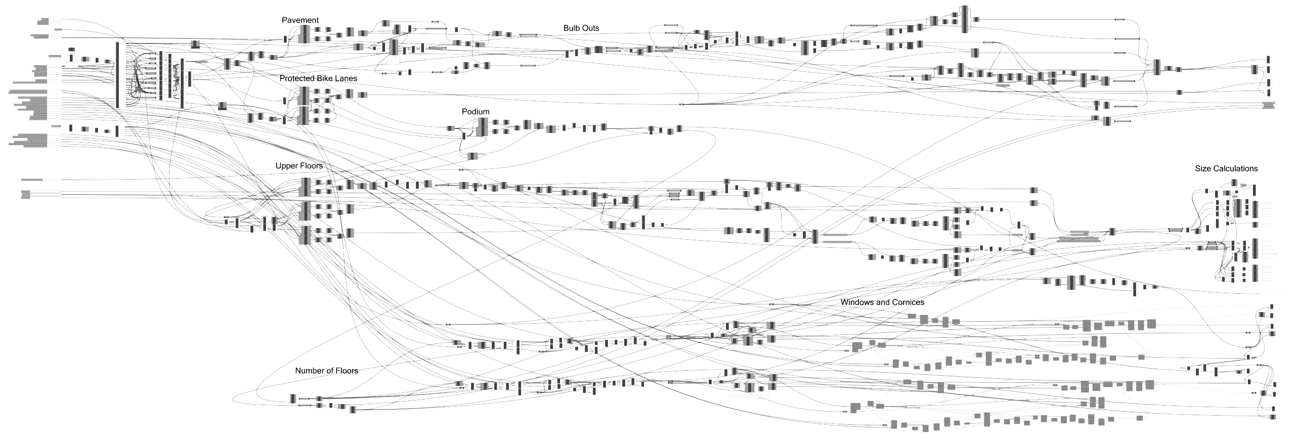
Building massing and details and pavement edges created with Grasshopper. Street centerlines, zoning districts, and parameters for each are combined into a model of what full build-out under specified zoning regulations might look like. Learn more >
Grasshopper script: pavement edges including bulb outs and protected bike lanes; building masses with windows and cornices; number of units and FAR calculations
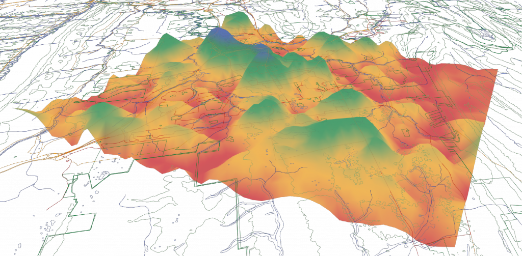
Development heat maps created with Grasshopper. A grid of measurement points is overlaid on GIS layers, each GIS layer creates its own heat map based on the location of features relative to nearby measurement points, and the individual heat maps are combined to create a complete roadmap for future development. Learn more >
Grasshopper script: draw and weight sliders, individual layer calculations, merging, and heat map creation.
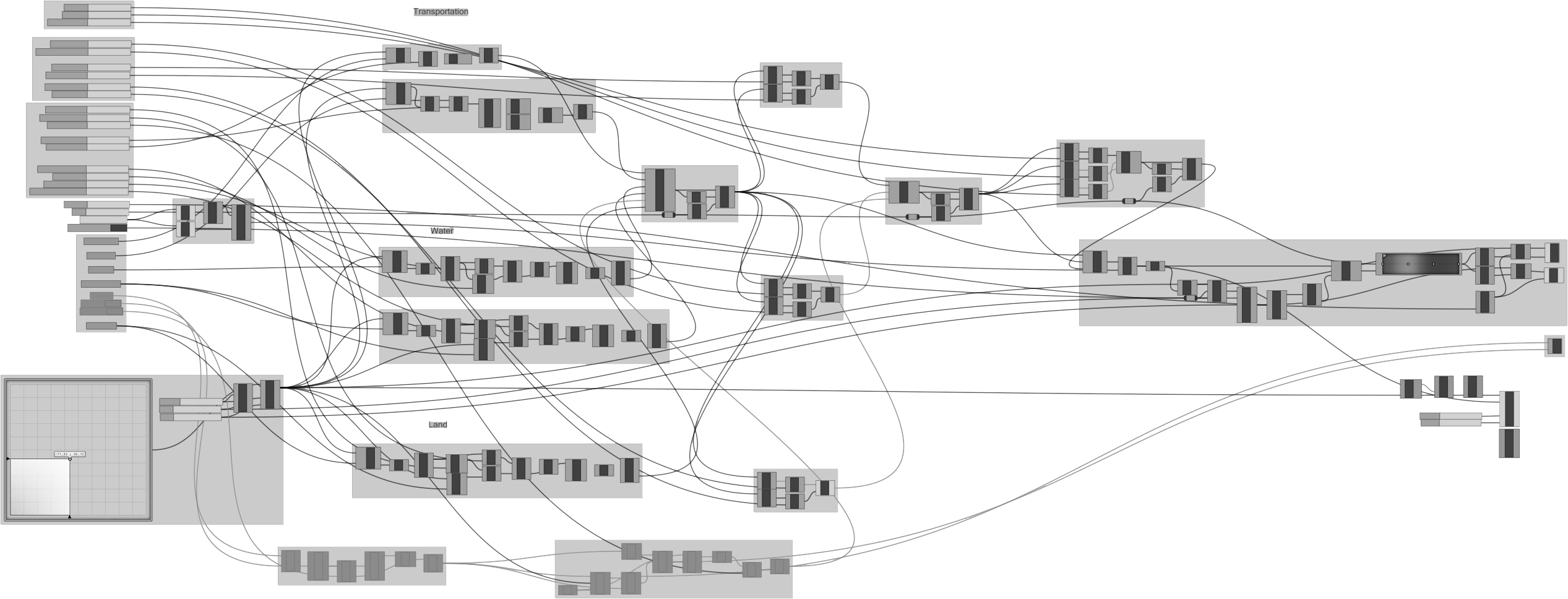
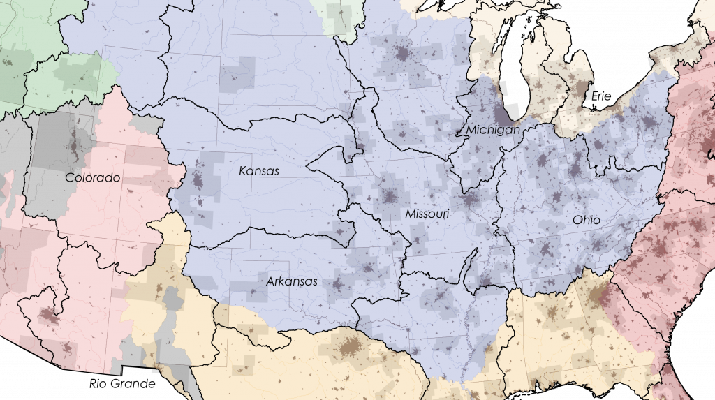
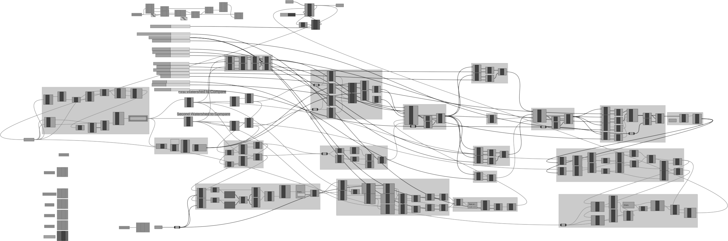
New state borders based on watersheds created with Grasshopper. Each pair of adjacent watersheds is analyzed based on four factors and assigned a propensity score. The pair of watersheds with the highest propensity is combined, and the process repeats. Learn more >
Grasshopper script: looping mechanism, watershed pairing, weight sliders, individual factor calculations, merging, and highest propensity union.